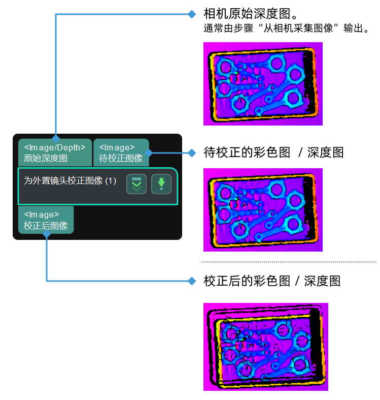
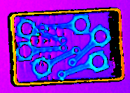
校正图像坐标系 您正在查看最新版本(V2.2.1)的文档。如果您想查阅其他版本的文档,可以点击页面右上角“切换版本”按钮进行切换。 ■ 如果您不确定当前使用的产品是哪个版本,请随时联系梅卡曼德技术支持。 功能描述 将彩色图校正至深度图坐标系,或将深度图校正至彩色图坐标系,使深度图与彩色图中的像素一一对应,便于后续的图像处理。 使用场景 深度图与彩色图的坐标系不一致时使用。 在不能足够了解工程中深度图与彩色图坐标系间关系的情况下,不推荐使用此步骤。 输入与输出 参数说明 参数 参数说明 校正模式 深度图至彩色图坐标系 深度图校正至彩色图坐标系 彩色图至深度图坐标系 彩色图校正至深度图坐标系 深度图至彩色图坐标系的转换如下所示: 原始深度图 待校正的深度图 校正后的深度图 彩色图至深度图坐标系的转换如下图所示: 原始深度图 待校正的彩色图 校正后的彩色图 该页面是否有帮助? 我要反馈 感谢您的支持! 可以通过以下方式反馈意见: 社区 反馈表单 定位标定球 检测圆心