Measure Regional Height
Description
This Step is used to set subregions in the feature region and calculate the mean height, point of maximum height, and point of minimum height of the surface data in each subregion. The Step can also measure the area of the surface data in each subregion and the volume relative to the reference plane.
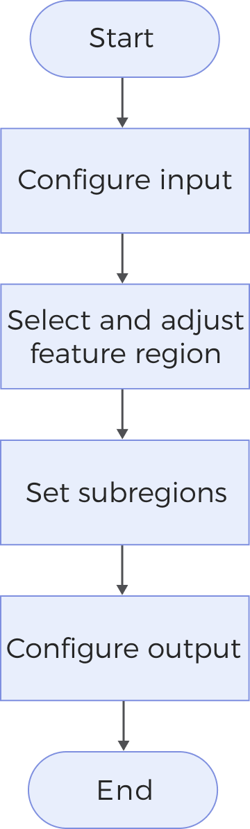
Workflow
The process of configuring this Step is shown below:
-
Configure the input. Connect the ports manually in the graphical programming workspace or select the input under Input in the parameter configuration panel.
-
Select the region type of the feature region under Parameters.
-
Set subregion-related parameters.
-
Select the desired output items under Output. For an expandable output item, click ▶ and configure the Lower Limit and Upper Limit values to set the acceptable range.
Input Description
| Parameter | Description |
|---|---|
Surface Data |
Image data in MRAW format, including a depth map and an intensity image. |
Alignment Parameter Group |
The parameter group used for the translation and rotation of the feature region(s). For more information, see Alignment Parameter Group. |
Reference Plane |
Height, area, and volume are all calculated relative to the reference plane. If no reference plane is provided, the default is the XOY plane. |
Parameter Description
|
|
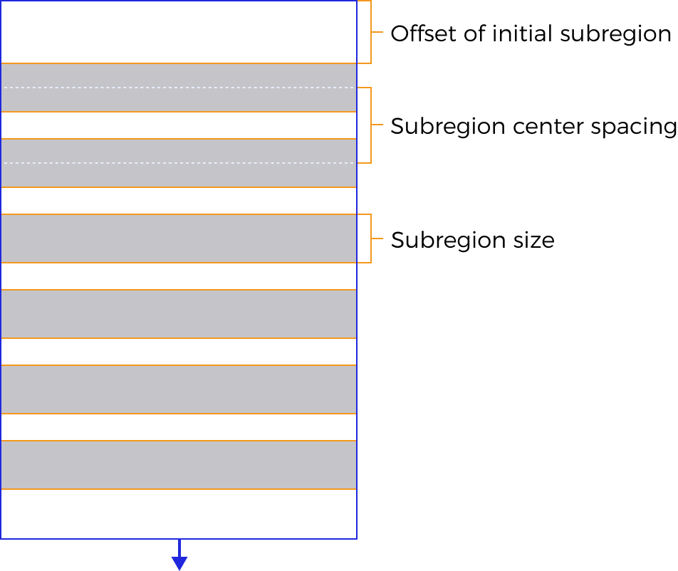
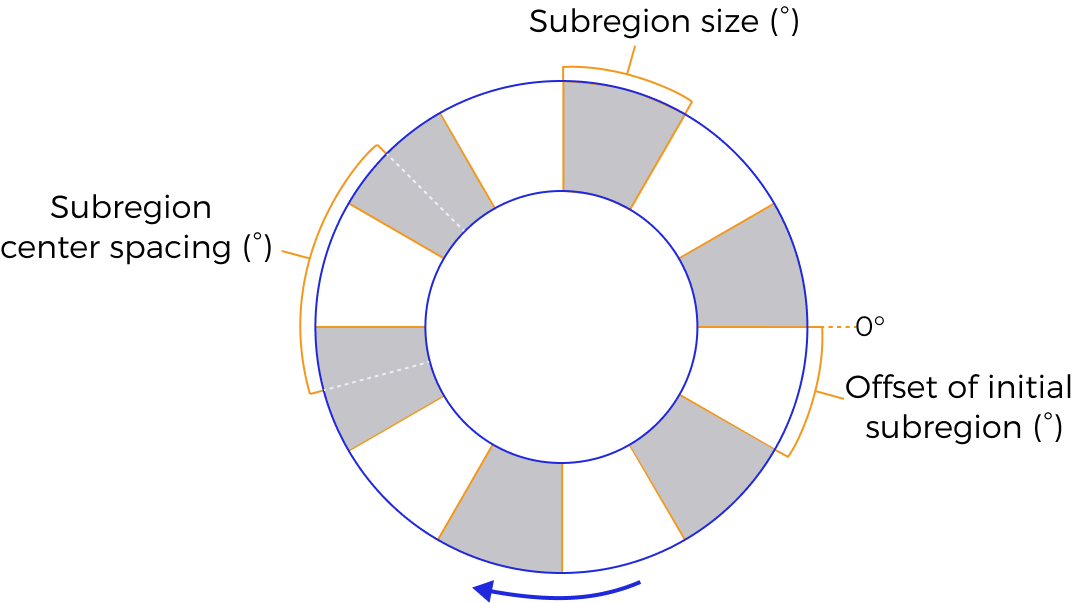
| The feature region is directional, and the setting of subregions is based on its orientation. When the feature region is a cuboid, its direction is indicated by an arrow in the visualization area (pointing along the negative Y-axis by default). When the feature region is an annular cylinder, the direction is defined as clockwise. |
Parameter |
Description |
||
Region Type |
Set subregions in the feature region to calculate the height and other parameters of the surface data in subregions. Options: Cuboid, Annular cylinder
|
||
Subregion Size |
|
||
Subregion Center Spacing |
The spacing between the centers of two neighboring subregions. |
||
Offset of Initial Subregion |
Specifies the offset of the initial subregion along the direction of the feature region, thereby determining the exact location of the initial subregion in the feature region. By default, no offset is applied, and the initial subregion starts from the beginning of the feature region: For a cuboid feature region, the beginning means the position with largest Y values; for an annular cylinder feature region, it means the position of 0°. |
||
Max Number of Subregions |
Limits the maximum number of subregions that can be generated within the feature region. |
Output Description
Select the output items, and the corresponding data will be output after the Step is run. You can select the output according to the actual measurement requirements.
|
If you select an expandable output item, you must expand it by clicking ▶, and then set the Lower Limit and Upper Limit values to determine the acceptable range. If the output value falls within the acceptable range, the measurement item is judged as passing (OK), or else it is judged as failing (NG). |
| Output Item | Description |
|---|---|
Valid Point Count |
The number of valid points in each subregion. |
Area above Plane |
The area of surface data above the reference plane within each subregion. |
Area below Plane |
The area of surface data below the reference plane within each subregion. |
Volume above Plane |
The volume enclosed by the reference plane and the surface data above it within each subregion. |
Volume below Plane |
The volume enclosed by the reference plane and the surface data below it within each subregion. |
Mean Height |
Mean point-to-reference-plane distance in each subregion. The height is positive for points above the plane and negative for points below the plane. |
Points of Max Height |
The point with the greatest distance to the reference plane in each subregion. The height is positive for points above the plane and negative for points below the plane. |
Points of Min Height |
The point with the smallest distance to the reference plane in each subregion. The height is positive for points above the plane and negative for points below the plane. |
Troubleshooting
|
CV-W3701
Error: The set “Region Type” is invalid.
Solution: Select a valid region type from the drop-down list.
CV-W3703
Error: The “Subregion Size” value must exceed 0.
Solution: Make sure the parameter value is greater than 0.
CV-W3704
Error: The “Offset of Initial Subregion” value must exceed 0.
Solution: Make sure the parameter value is greater than 0.
CV-W3705
Error: The “Subregion Center Spacing” value must exceed 0.
Solution: Make sure the parameter value is greater than 0.
CV-W3706
Error: The “Max Number of Subregions” value must be within 0–5000.
Solution: Make sure the parameter value is within 0–5000.