Get Highest Areas in Depth Image
Function
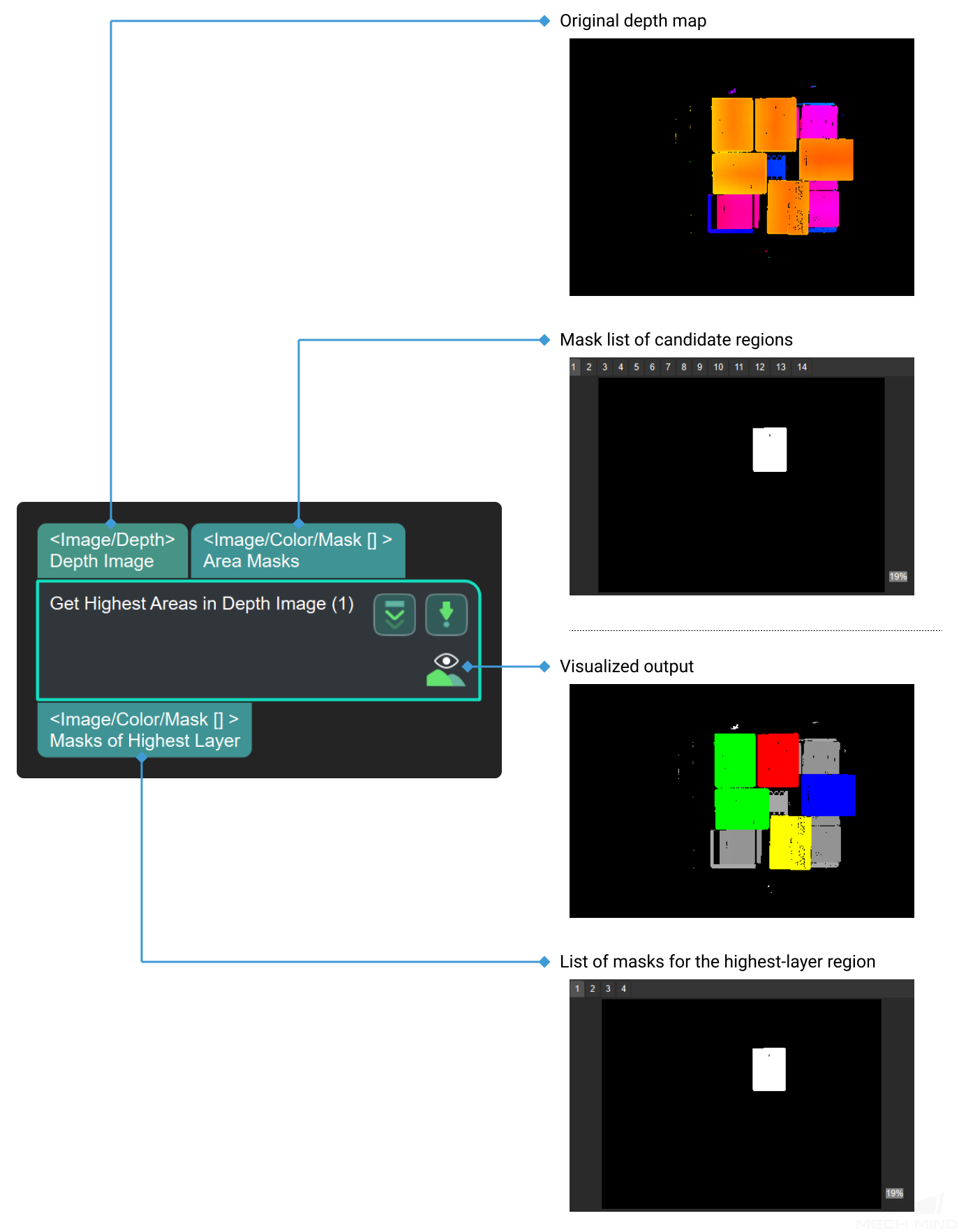
This Step utilizes the given depth map and mask list to segment the image into multiple areas, and output the area that is closest to the camera, while other areas will be discarded.

Sample Scenario
This Step is usually used in carton depalletizing applications to identify the objects on the highest layer. It is usually connected with Steps as Invalidate Depth Pixels Outside 3D ROI, Merge Mask Images, Segment Depth Image, etc.
Input and Output
Parameters
LayerHeight
Default Value: 0.1Instruction: The height of the top.LayerDiffTolerance
Default Value: 0.5Instruction: This parameter is the upper limit of the ratio of height difference between the different areas with different height to layerHeight . The areas whose difference of height are less than this paramter are believed to have the same height. Otherwise, areas are considered to have different height when this value is small.